CPlaNet: Enhancing Image Geolocalization by Combinatorial Partitioning of Maps
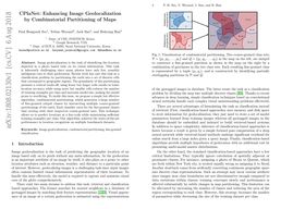
Image geolocalization is the task of identifying the location depicted in a photo based only on its visual information. This task is inherently challenging since many photos have only few, possibly ambiguous cues to their geolocation. Recent work has cast this task as a classification problem by partitioning the earth into a set of discrete cells that correspond to geographic regions. The granularity of this partitioning presents a critical trade-off; using fewer but larger cells results in lower location accuracy while using more but smaller cells reduces the number of training examples per class and increases model size, making the model prone to overfitting. To tackle this issue, we propose a simple but effective algorithm, combinatorial partitioning, which generates a large number of fine-grained output classes by intersecting multiple coarse-grained partitionings of the earth. Each classifier votes for the fine-grained classes that overlap with their respective coarse-grained ones. This technique allows us to predict locations at a fine scale while maintaining sufficient training examples per class. Our algorithm achieves the state-of-the-art performance in location recognition on multiple benchmark datasets.
PDF Abstract ECCV 2018 PDF ECCV 2018 AbstractDatasets
Results from the Paper
 Ranked #1 on
Photo geolocation estimation
on Im2GPS
(Reference images metric)


 ImageNet